
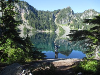
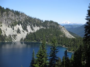
This hike is from Salmon la Sac. There are other ways, but they are much longer. The first couple of miles are gentle into Hyas Lake. It is a pretty lake. No-one was camping there on a Wednesday, but by Friday lots of groups with small children were arriving. After the lake, you will gain 1000 feet up to Deception Pass - most of that in about a two mile stretch. Around mile four, you will pass the intersection for Tuck and Robin Lakes - spectacular, but one of the more brutal 2-3 miles you will ever do. From the intersection with the PCT, turn right; then the next left goes to Marmot. You will pass some tarns and a small campsite on the right about one mile past the intersection. Around 1.5 miles in are some social trails over to Hozbiz Lake in a beautiful basin area. It has a couple of campsites. After that, the trail descends about 600 feet before traversing; then regaining altitude to the unmarked left leading up to the lake. Don't bother to go back and over to Clarice - it is just a marsh. Water was plentiful along the trail. BE AWARE: This area is overcrowded - even on a Wednesday night we had trouble finding a campspot - people are camping within feet of each other. Do not expect privacy or solitude!
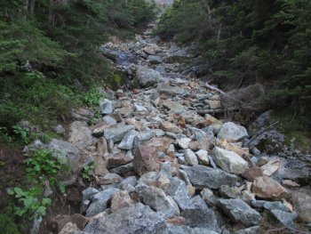
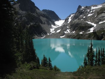
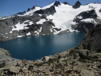
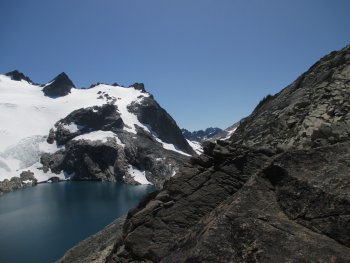
To get to Jade: follow the rooty and at times a bit sketchy bootpath around Marmot Lake. It will head out over roots, boulders, and then straight up a gully with loose talus. It is challenging to descend. The bootpath gets better towards the top. It comes out to a lovely tarn; then continues mostly flat to No Name Lake - the only lake that wasn't being completely thronged with people - at least not until the weekend. Descend about a tenth of a mile to Jade. It is spectacular - lots of water flowing into lake including some delightful pools. Unfortunately, it is being loved to death with reports of people camping on vegetation due to lack of actual spots to accommodate the hoards visiting it.
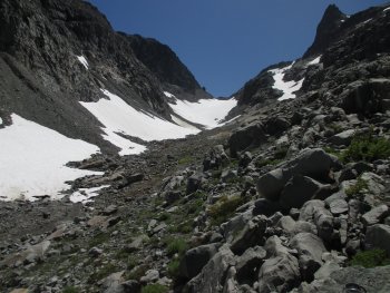
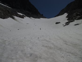
From Jade to Dip Top Gap, I will give the safest route here. Avoid the upper traverse - it is not very safe. Continue around the lake until you come to a place where the bootpath goes up or to the right a short, steep path down - this is sandy and slippery the lower 2/3, but it is safer and better than the alternative. Make your way up the gully - there are some cairns, but the easiest ways will be relatively obvious to follow up through the boulders. You will want to be on the right side of the creek eventually. When we did it, it was full on snow from 1/2 up. Bring microspikes in case as it is super steep going up that snow; down is scarier. Great view of Pea Soup from above and one tent spot, but you'd have to carry your water up a steep scramble. You can take a path through boulders down to Pea Soup but no reason to do so - no place to camp/no beach that we could see. We discussed if people summit Daniel from there, but we aren't sure. Views are superb, but do NOT attempt this unless you have the skills and fitness level to handle it safely.
I am just learning to use Gaia so I am not sure how to publish my track. I did a GPS track from Marmot to Dip Top Gap. It includes starting the high route contour and going back to the lower route.